

Newfoundland, Canada
100%
The O’Brien Gold Property covers approximately 2,100 hectares (21 km²) in central Newfoundland, Canada, located 28 km west of Gander and approximately 100 km northeast of the Valentine Lake gold deposit.
The property lies within the prospective Exploits Subzone of the Dunnage Zone, adjacent to the Mt Peyton Intrusive Suite. The 13.5 km Mt Peyton Trend runs along the western side of the property and is associated with regional gold, silver, arsenic and antimony occurrences.
Three priority exploration areas have been identified: the South Eastern Target, Central Target and North-Western Target. The South Eastern Target contains a significant magnetic low approximately 2 km wide, coincident with an electromagnetic conductor and interpreted fault structures, representing a conceptual, untested target for gold mineralisation.
The nearby Slip gold showing, located approximately 900 metres north-northwest of the property boundary, has returned historical gold assays of up to 28.6 g/t Au. These results relate to mineralisation outside the property and are not necessarily indicative of mineralisation within O’Brien.
A Phase 1 exploration programme commenced on 31 October 2026, focusing initially on the South Eastern Target. The programme includes Spatiotemporal Geochemical Hydrocarbon (SGH) soil sampling, designed to investigate potential buried gold mineralisation beneath glacial cover and wetlands.
Ontario, Canada
100%
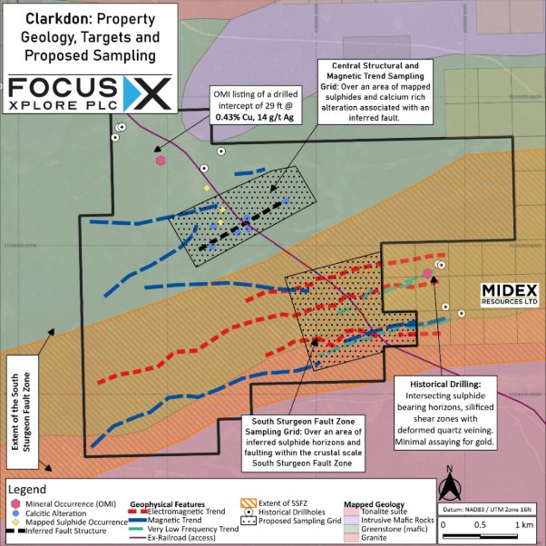
The Clarkdon Gold Property covers approximately 1,800 hectares (18 km²), located 50 km northwest of Ignace in northwestern Ontario, within the Sturgeon Lake greenstone belt of the Superior craton.
The property is crossed in the south by the South Sturgeon Fault Zone, a major regional geological structure considered prospective for structurally controlled gold mineralisation.
Two priority exploration areas have been identified: the South Sturgeon Fault Zone and the Central Structural & Magnetic Corridor. These targets are supported by historical geophysical data, mapped alteration and sulphide occurrences, but have not been systematically explored for gold.
A Phase 1 exploration programme commenced in October 2026, comprising geological prospecting and systematic soil geochemical sampling across the two target areas.
Ontario, Canada
100%
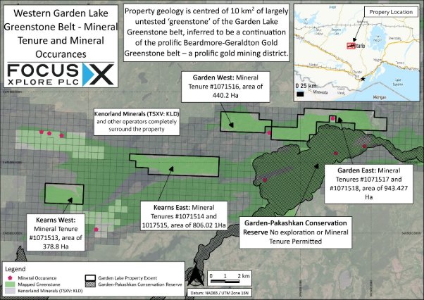
The Garden Lake Properties comprise two neighbouring gold exploration properties, Garden and Kearns, covering a combined 2,569 hectares (25.69 km²), approximately 135 km north-northwest of Thunder Bay, Ontario.
Both properties lie within the Garden Lake greenstone belt, interpreted as a westward continuation of the historically gold-producing Beardmore-Geraldton greenstone belt.
Priority exploration targets include approximately 9.6 km of inferred banded iron formation at Garden and over 2 km at Kearns, together with interpreted fault structures, geophysical anomalies and altered volcanic rocks. These targets have not been systematically explored for gold.
The historical Conick Lake gold showing, approximately 200 m outside the Garden Property boundary, has returned selective grab samples of up to 51.4 g/t gold. Results from neighbouring ground are not necessarily indicative of mineralisation on the Garden Lake Properties.
Phase 1 exploration commenced on 25 October 2026, comprising geological prospecting and soil geochemical sampling across Garden East, Garden West, Kearns East and Kearns West.
Ontario, Canada
100%
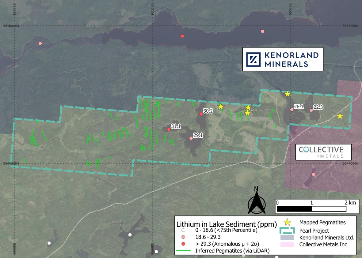
The Pearl claims cover 1,475 hectares encompassing multiple untested inferred pegmatites identified though LiDAR imagery1.
The inferred pegmatites have the same orientation and similar outcrop to historically mapped pegmatites2 in the north and east of the property.
Proximal to waterbodies where lake sediments are recorded as having anomalous or highly elevated results3,4 for lithium and elements associated with LCT pegmatites5.
Ontario, Canada
100%
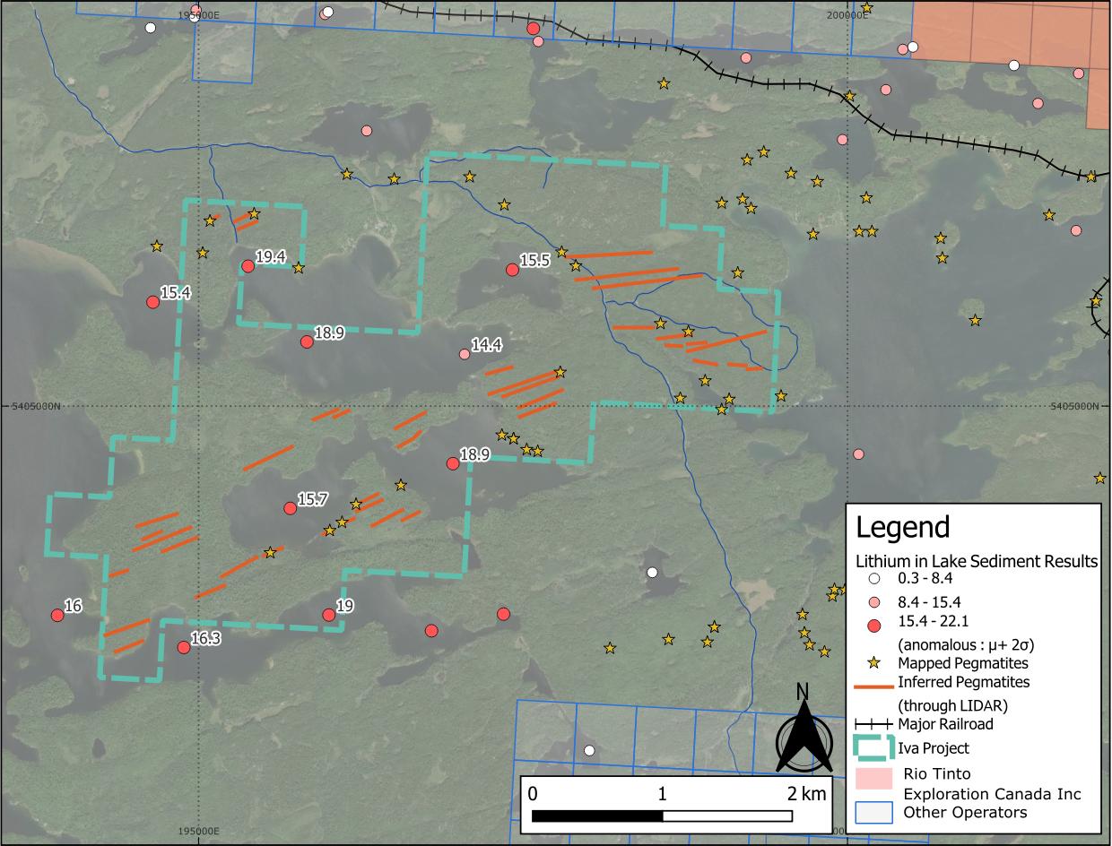
Iva is a 642 hectare property centred on anomalous lithium, caesium and beryllium lake sediment1,2 assay results.
Positioned at the interface between granite and metasedimentary lithologies3, a favourable setting for LCT pegmatites4.
Nearby lithium projects highlight regional potential: Patriot Lithium's Bull Project sits 11 km to the east, and the Niobe-Nym Lakes LCT pegmatites lie 20 km away – both are associated with the same intrusion as Iva.
Ontario, Canada
100%
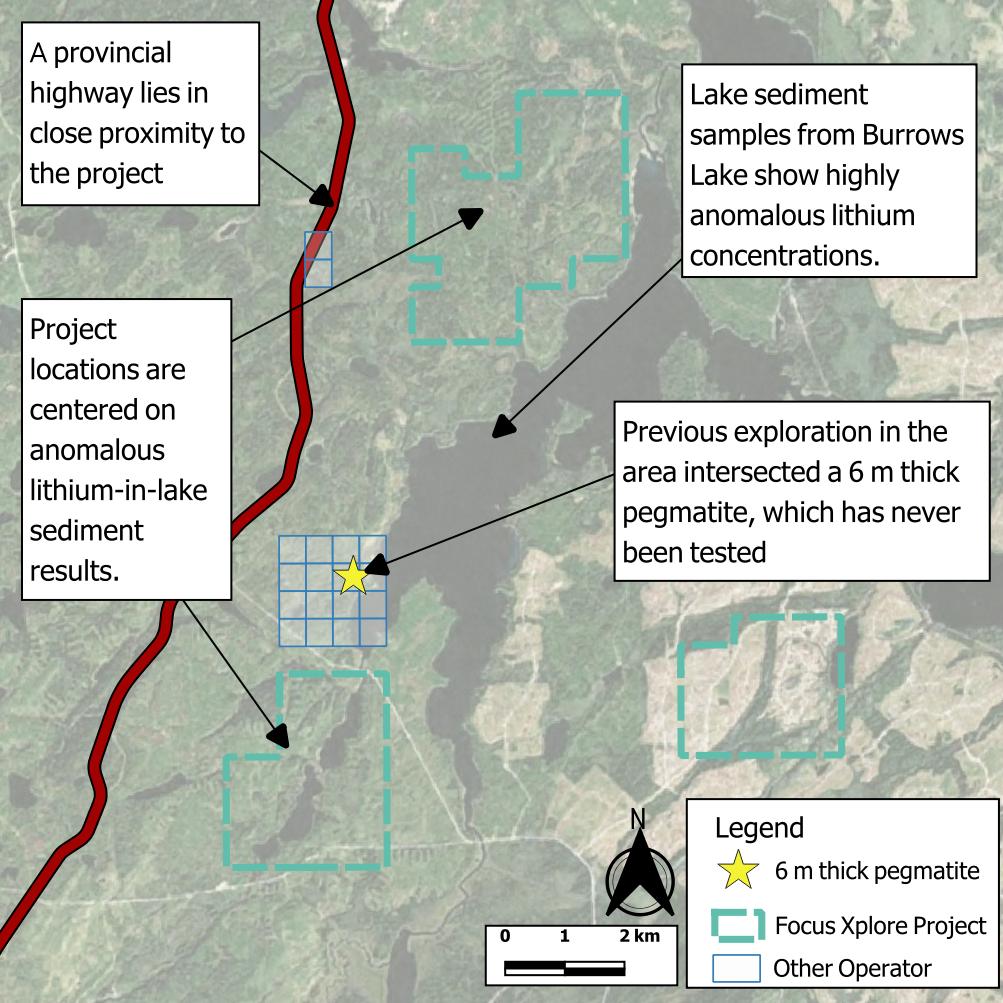
The Biscuit Creek Project comprise three under-explored properties covering 2,400 hectares in an area outlined by the Ontario Survey as a target for grassroots lithium exploration1.
Elevated lithium and caesium are known from deep lake sediment assays and the local geology is recognised as having potential to host lithium-bearing pegmatites2.
Historic drilling in the 1970s3,4 within 2 km of the projects hit 5 metre-thick pegmatites that were never assayed for lithium.
Ontario, Canada
100%
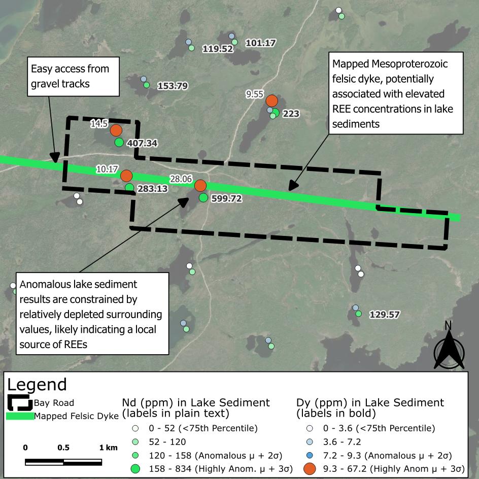
Bay Road covers 425 hectares directly south of the fertile White Otter Batholith.
The property is centred on 6 km of felsic intrusive rock1 mapped by the Ontario Geological Survey.
The intrusive feature has a spatial relationship with highly anomalous REEs2,3,4 in lake sediment assays, specifically “magnet metals” dysprosium and neodymium – used in the manufacture of modern permanent magnets.
