Pearl

Location

Ontario, Canada

Ownership

100%

Minerals

Lithium

Project Summary

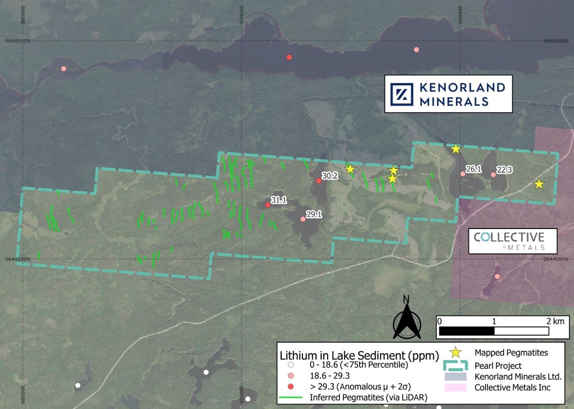
  • The Pearl claims cover 1,475 hectares encompassing multiple untested inferred pegmatites identified though LiDAR imagery1.

  • The inferred pegmatites have the same orientation and similar outcrop to historically mapped pegmatites2 in the north and east of the property.

  • Proximal to waterbodies where lake sediments are recorded as having anomalous or highly elevated results3,4 for lithium and elements associated with LCT pegmatites5.

1: Ontario Ministry of Natural Resources and Forestry, accessed 24 March 2025, Forest Resources Inventory leaf-on LiDAR, Ontario GeoHub <https://geohub.lio.gov.on.ca/
2: Fenwick, K.G., 1967, Whitemud Lake area (Fredart-Whitemud lakes area), District of Kenora (Patricia Portion), Ontario Geological Survey, P0412
3: Ontario Geological Survey, 2001, Lake Sediment Analytical Data for the Sioux Lookout-Bamaji Lake Area: Operation Treasure Hunt, MRD088
4: Ontario Geological Survey, 2002, Lake Sediment Geochemical Data from the Perrault Falls Survey Area, Northwestern Ontario: Operation Treasure Hunt, MRD106
5: Bradley, D.C., McCauley, A.D., Stillings L.M., 2017, Mineral-Deposit Model for Lithium-Cesium-Tantalum Pegmatites, USGS.

Project Details

Pearl map