Iva

Location

Ontario, Canada

Ownership

100%

Minerals

Lithium

Project Summary

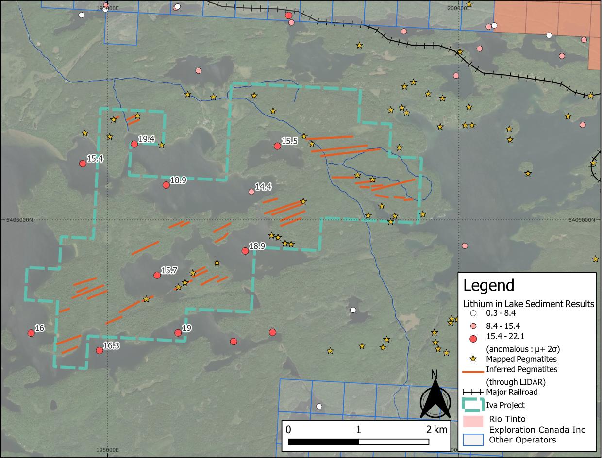
  • Iva is a 642 hectare property centred on anomalous lithium, caesium and beryllium lake sediment1,2 assay results.

  • Positioned at the interface between granite and metasedimentary lithologies3, a favourable setting for LCT pegmatites4.

  • Nearby lithium projects highlight regional potential: Patriot Lithium's Bull Project sits 11 km to the east, and the Niobe-Nym Lakes LCT pegmatites lie 20 km away – both are associated with the same intrusion as Iva.

1: Dyer, R.D., 1999, Lake Sediment and Water Geochemistry Data from the Atikokan-Lumby Lake Area, Northwestern Ontario (MRD043)
2: Jackson, J.E., 2001, Lake Sediment and Water Geochemical Data from the Shebandowan Lake Area, Northwestern Ontario (MRD076)
3: Pirie, J. 1978, Ontario Geological Survey Crooked Pine Lake, Rainy River District Geological Map #M2405
4: Bradley, D.C., McCauley, A.D., Stillings L.M., 2017, Mineral-Deposit Model for Lithium-Cesium-Tantalum Pegmatites, USGS.
 

Project Details

Iva map