Ellie

Location

Ontario, Canada

Ownership

100%

Minerals

Lithium

Project Summary

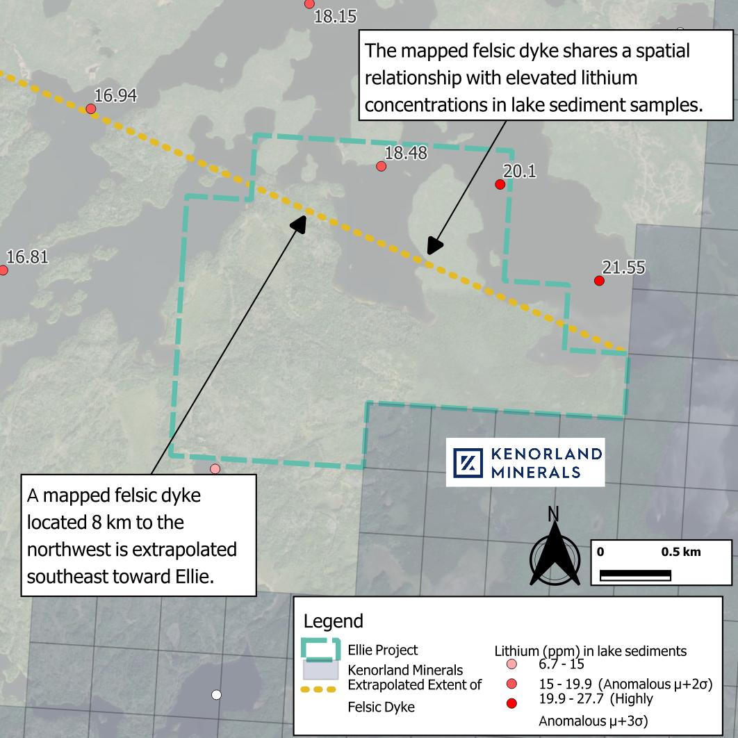
  • Ellie covers 530 ha along trend from a felsic dyke1, with highly anomalous lithium in lake sediment results2,3 immediately to the northeast.

  • Anomalous lithium, beryllium and niobium in lake sediment results are evident in other nearby lakes.

  • Located on the south-western flank of the Eye-Dashwa Intrusion – an Archean granodiorite – and a gabbroic intrusion.

  • Kenorland Mineral’s (TSXV: KLD) Algoman gold and lithium project lies adjacent to the south.

1: Santaguida, F., 2001, Ontario Geological Survey,. Precambrian Geology Compilation Series - Quetico Sheet, 2000 Series Map (M2663).
2: Dyer, R.D., 1999, Lake Sediment and Water Geochemistry Data from the Atikokan-Lumby Lake Area, Northwestern Ontario (MRD043).
3: Jackson, J.E., 2001, Lake Sediment and Water Geochemical Data from the Shebandowan Lake Area, Northwestern Ontario (MRD076).

Project Details

Ellie map