Burrows Projects

Location

Ontario, Canada

Ownership

100%

Minerals

Lithium

Project Summary

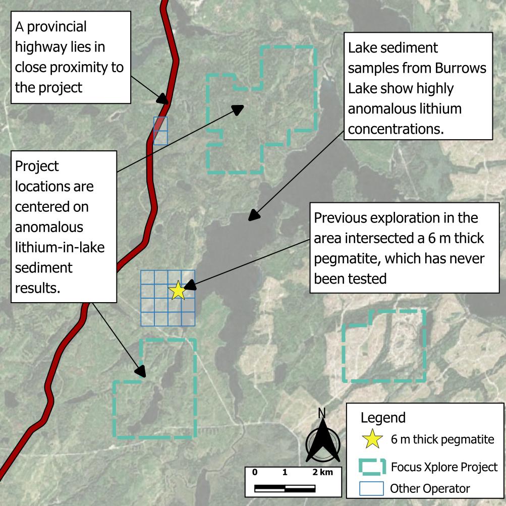
  • The Burrows Projects comprise three under-explored properties covering 2,400 hectares in an area outlined by the Ontario Survey as a target for grassroots lithium exploration1.

  • Elevated lithium and caesium are known from deep lake sediment assays and the local geology is recognised as having potential to host lithium-bearing pegmatites2.

  • Historic drilling in the 1970s3,4 within 2 km of the projects hit 5 metre-thick pegmatites that were never assayed for lithium.

1: Paju, G.F. 2019. Beardmore to Geraldton: A grassroots look for lithium in a prolific gold camp; in Report of Activities 2018, Resident Geologist Program, Thunder Bay North Regional Resident Geologist Report: Thunder Bay North District; Ontario Geological Survey, Open File Report 6352, p.55-71.
2: Bradley, D.C., McCauley, A.D., Stillings L.M., 2017, Mineral-Deposit Model for Lithium-Cesium-Tantalum Pegmatites, USGS.
3: Hudson Bay Exploration & Development Co Ltd, 1973, Hudson Bay Exploration And Development Company Limited, Final Report On Exploration, Exploration Assistance Agreement. Geraldton - Beardmore Area, Thunder Bay Mining Division - Ontario, Longlac Project; Contract No. Gb-25 (Assessment Report Number: 42E15NE8354 ).
4: Moly-Ore Mines Ltd, 1965, Report on Diamond Drilling Program on Moly Ore Mines Limited, Burrows Lake Property, Area of Burrows Lake, Port Arthur Mining Division, (Assessment Report Number: 42E15NW0002).


Project Details

Burrows Projects map