Bay Road

Location

Ontario, Canada

Ownership

100%

Minerals

Magnet Metals (REE)

Project Summary

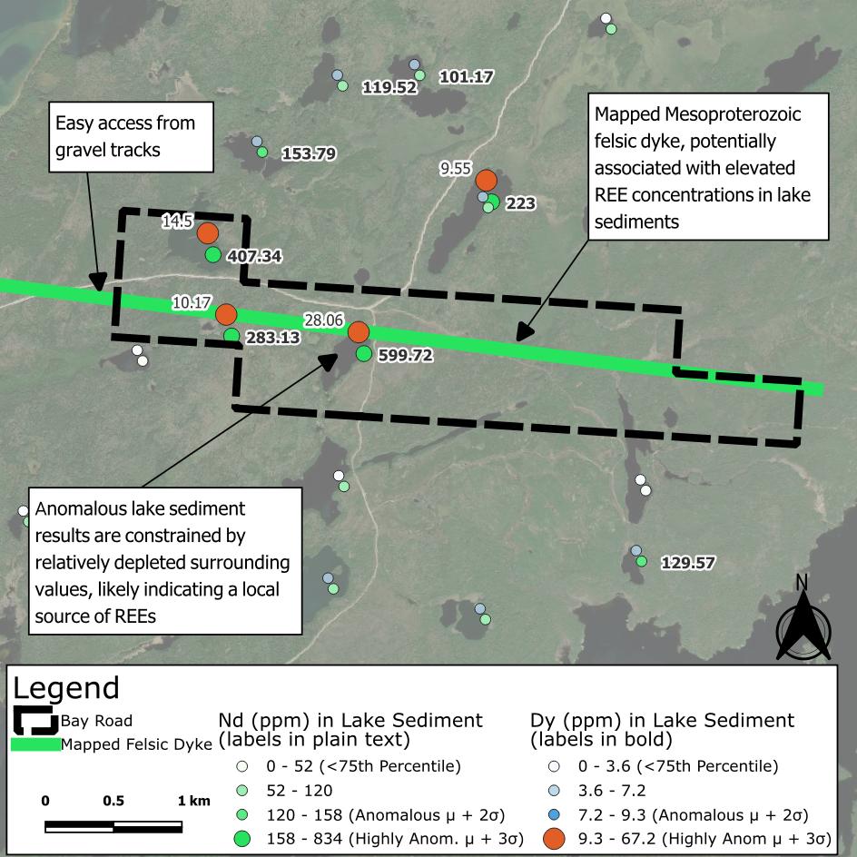
  • Bay Road covers 425 hectares directly south of the fertile White Otter Batholith.

  • The property is centred on 6 km of felsic intrusive rock1 mapped by the Ontario Geological Survey.

  • The intrusive feature has a spatial relationship with highly anomalous REEs2,3,4 in lake sediment assays, specifically “magnet metals” dysprosium and neodymium – used in the manufacture of modern permanent magnets.

1: Santaguida, F., 2001, Ontario Geological Survey,. Precambrian Geology Compilation Series - Quetico Sheet, 2000 Series Map (M2663).
2: Dyer, R.D., 1999, Lake Sediment and Water Geochemistry Data from the Atikokan-Lumby Lake Area, Northwestern Ontario (MRD043).
3: Jackson, J.E. 2003, Lake Sediment Geochemical Data from the Ignace Survey Area, Northwestern Ontario: Operation Treasure Hunt (MRD118).
4: Dyer, R.D., Burke, H.E. 2012, Lake Sediment and Water Geochemical Data from the Mine Centre Area, Northwestern Ontario (MRD296).

Project Details

Bay Road map