
Ontario, Canada
100%
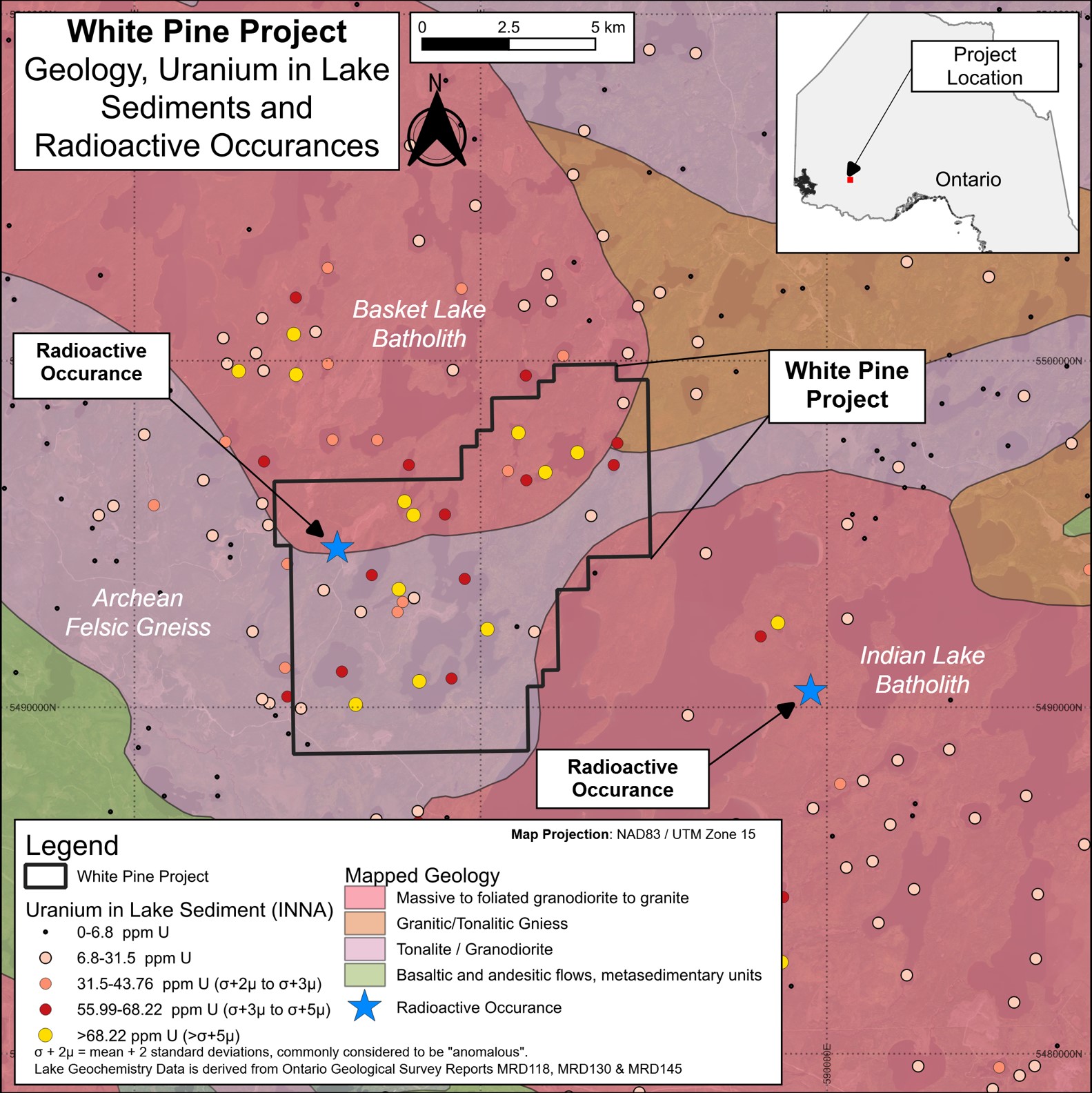
White Pine is supportive of intrusive-type uranium (an example is Rössing in Namibia) with two granitic rock batholiths intruded into an area of gneiss1.
Statistical analysis completed over a lake sediment sampling study containing more than 4,000 samples2 and covering approximately 15,000 km2 delineates White Pine as a prospective uranium target when plotting the 99.5% percentile uranium assay data.
Very highly anomalous and extremely anomalous uranium in lake sediments compared with regional data, including values of up to 149 ppm uranium and nine samples with uranium values in excess of five standard deviations above mean.
Radiometric survey results3 indicate an intense radiometric signature over the property, extending at least 14 km. This area aligns closely with the anomalous uranium-in-lake sediments described above.
Minimal fieldwork to date, with no systematic or modern sampling.
Ontario, Canada
100%
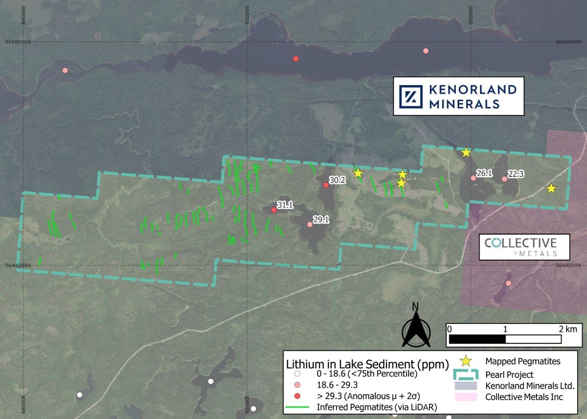
The Pearl claims cover 1,475 hectares encompassing multiple untested inferred pegmatites identified though LiDAR imagery1.
The inferred pegmatites have the same orientation and similar outcrop to historically mapped pegmatites2 in the north and east of the property.
Proximal to waterbodies where lake sediments are recorded as having anomalous or highly elevated results3,4 for lithium and elements associated with LCT pegmatites5.
Ontario, Canada
100%
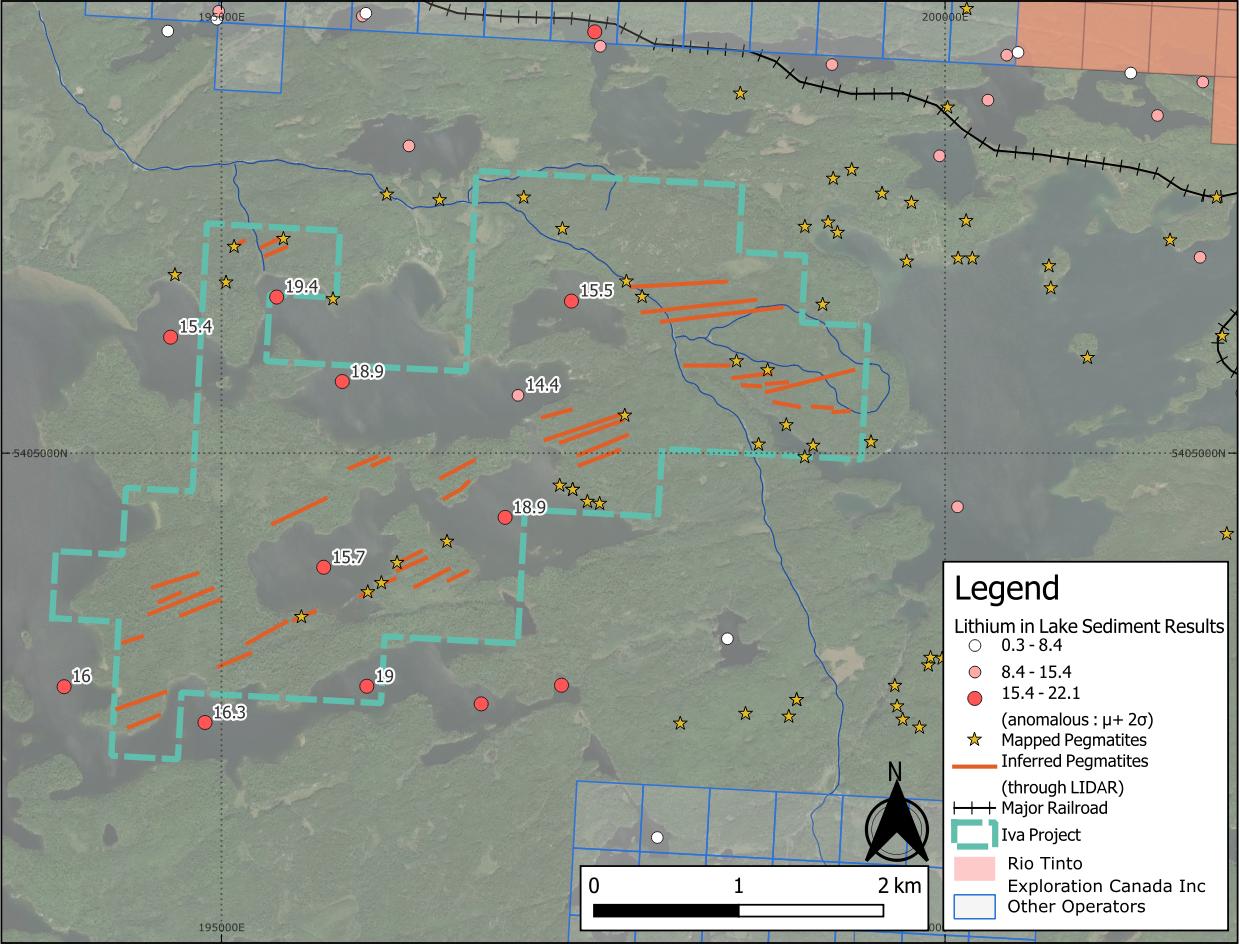
Iva is a 642 hectare property centred on anomalous lithium, caesium and beryllium lake sediment1,2 assay results.
Positioned at the interface between granite and metasedimentary lithologies3, a favourable setting for LCT pegmatites4.
Nearby lithium projects highlight regional potential: Patriot Lithium's Bull Project sits 11 km to the east, and the Niobe-Nym Lakes LCT pegmatites lie 20 km away – both are associated with the same intrusion as Iva.
Ontario, Canada
100%
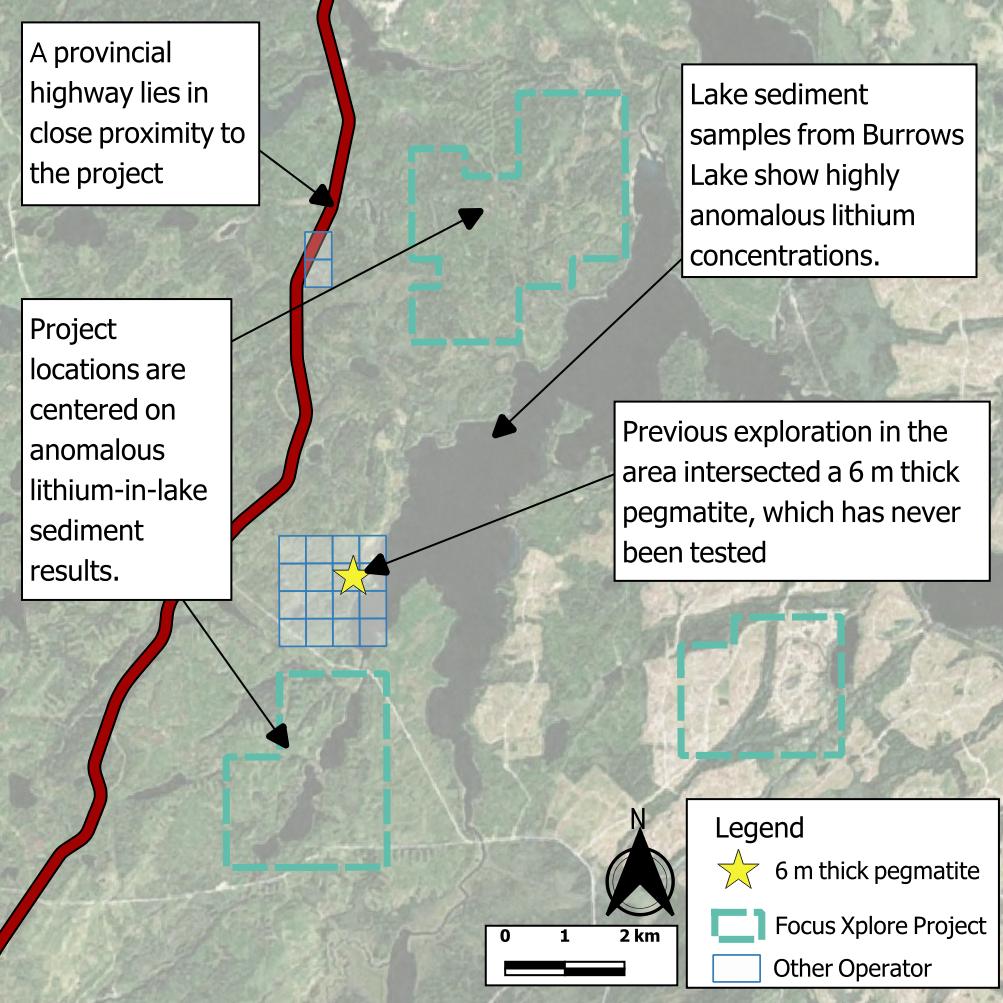
The Burrows Projects comprise three under-explored properties covering 2,400 hectares in an area outlined by the Ontario Survey as a target for grassroots lithium exploration1.
Elevated lithium and caesium are known from deep lake sediment assays and the local geology is recognised as having potential to host lithium-bearing pegmatites2.
Historic drilling in the 1970s3,4 within 2 km of the projects hit 5 metre-thick pegmatites that were never assayed for lithium.
Ontario, Canada
100%
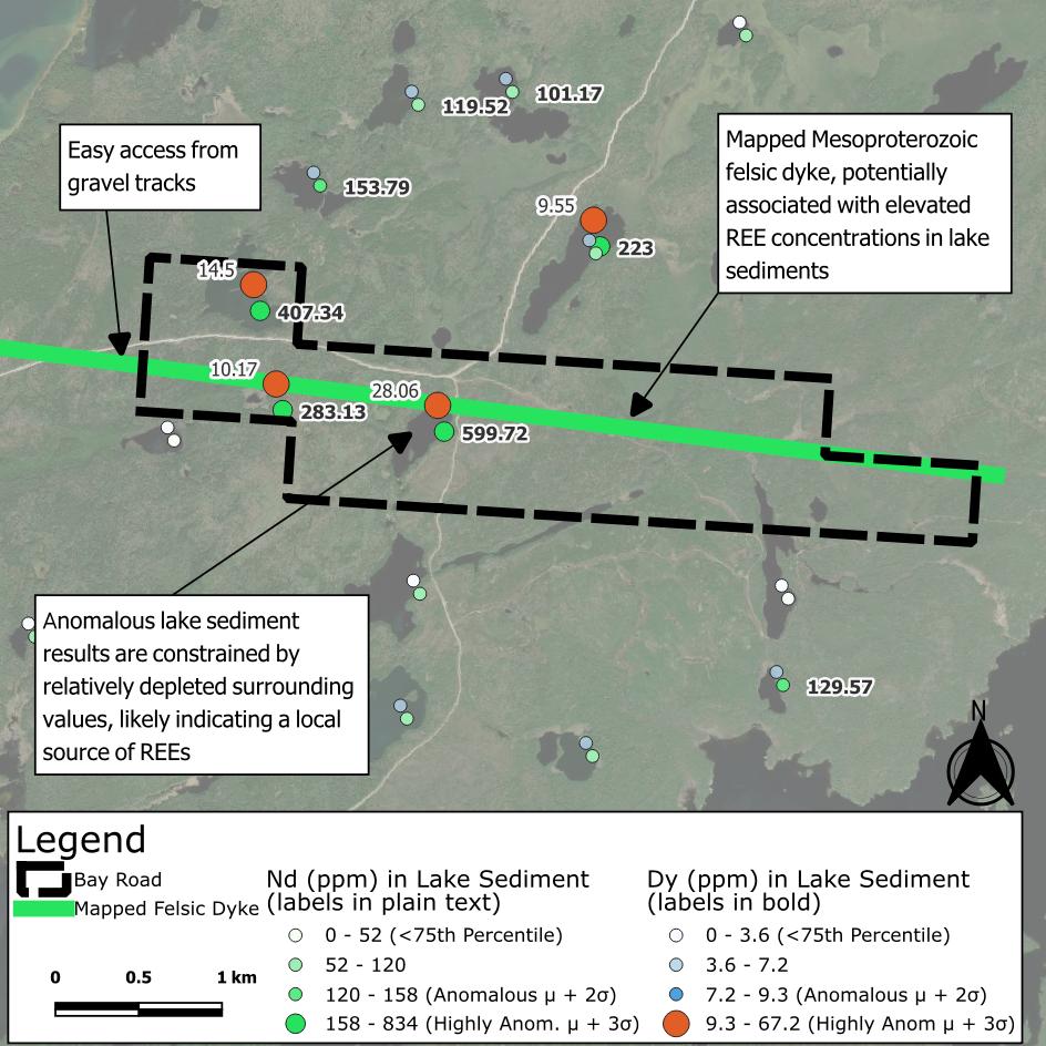
Bay Road covers 425 hectares directly south of the fertile White Otter Batholith.
The property is centred on 6 km of felsic intrusive rock1 mapped by the Ontario Geological Survey.
The intrusive feature has a spatial relationship with highly anomalous REEs2,3,4 in lake sediment assays, specifically “magnet metals” dysprosium and neodymium – used in the manufacture of modern permanent magnets.
Ontario, Canada
100%
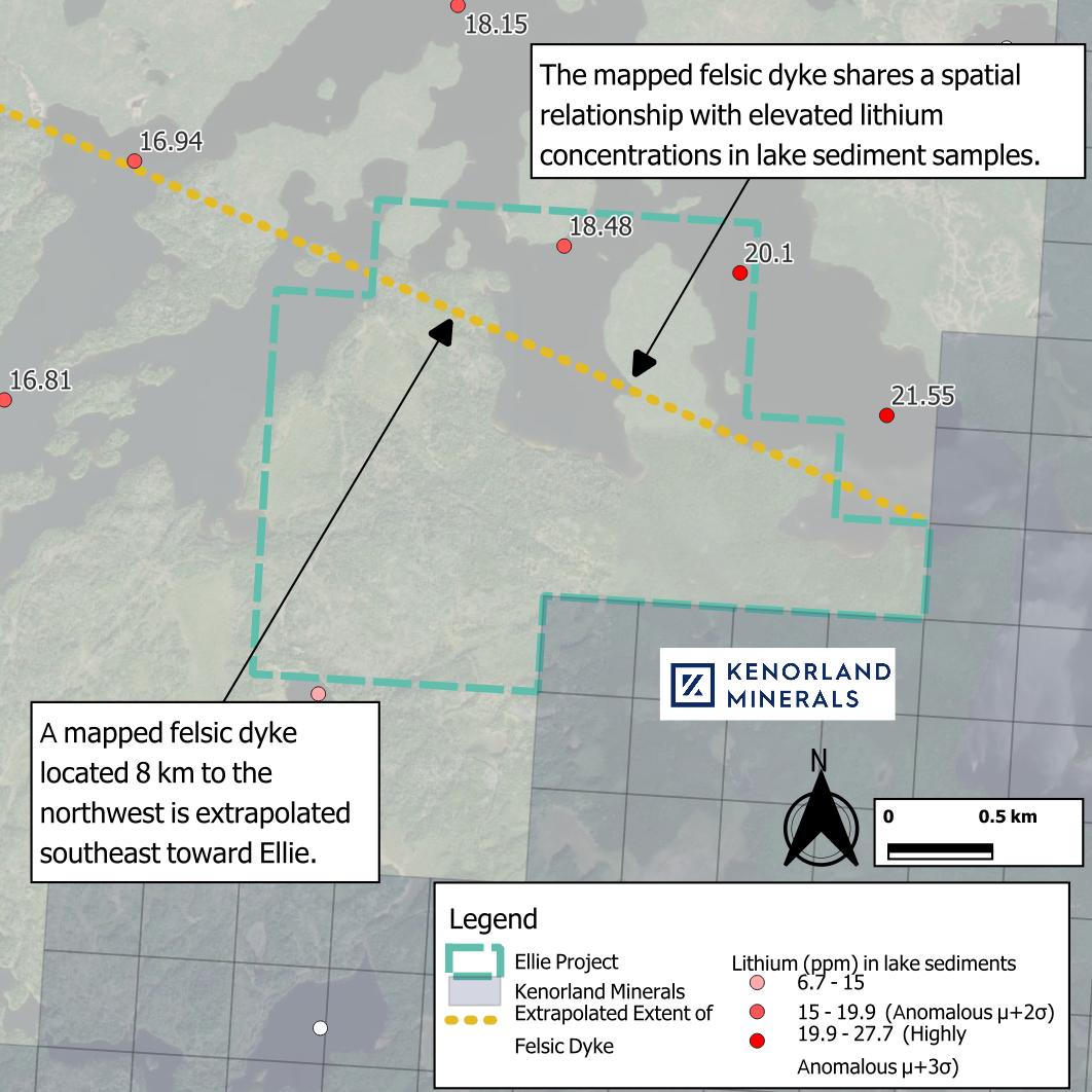
Ellie covers 530 ha along trend from a felsic dyke1, with highly anomalous lithium in lake sediment results2,3 immediately to the northeast.
Anomalous lithium, beryllium and niobium in lake sediment results are evident in other nearby lakes.
Located on the south-western flank of the Eye-Dashwa Intrusion – an Archean granodiorite – and a gabbroic intrusion.
Kenorland Mineral’s (TSXV: KLD) Algoman gold and lithium project lies adjacent to the south.
Ontario, Canada
100%
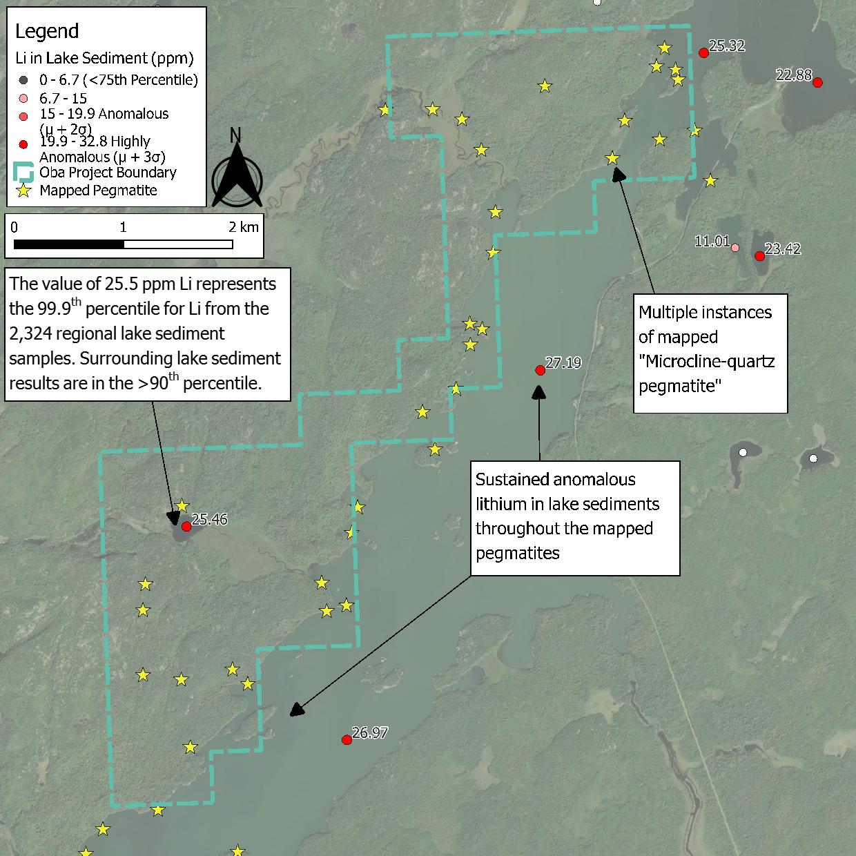
1,175 hectare property located within a large 90 km x 40 km felsic intrusion.
Multiple pegmatites were mapped1 by the Ontario Geological Survey in the late 1970s but never tested or evaluated.
The pegmatite occurrences are located in the vicinity of highly anomalous lithium, caesium and beryllium in lake sediment values2.